Genetic Distances
Genetic similarity / proximity / distance maps
From scaled G25 coordinates
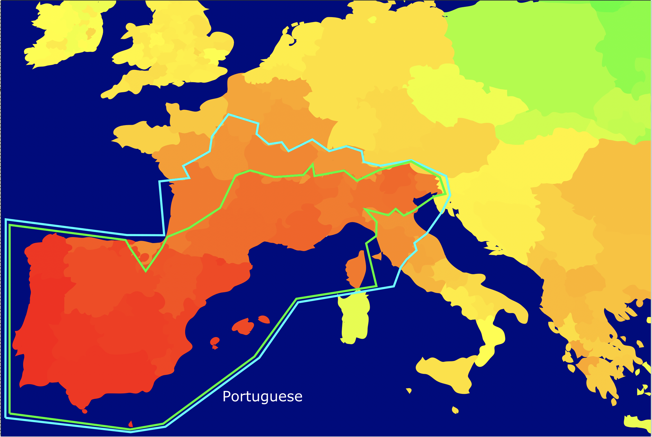
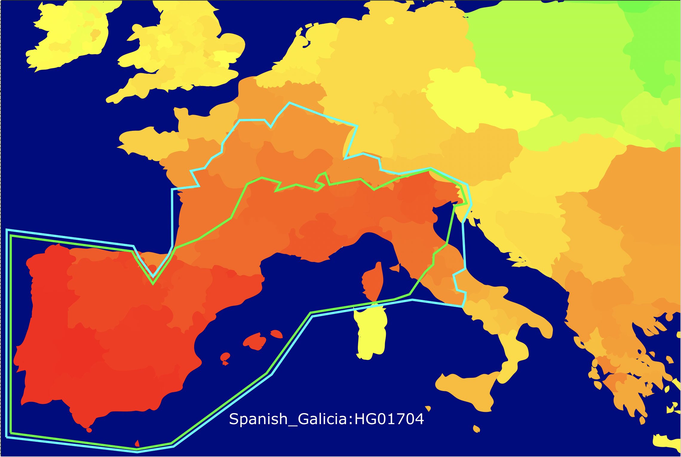
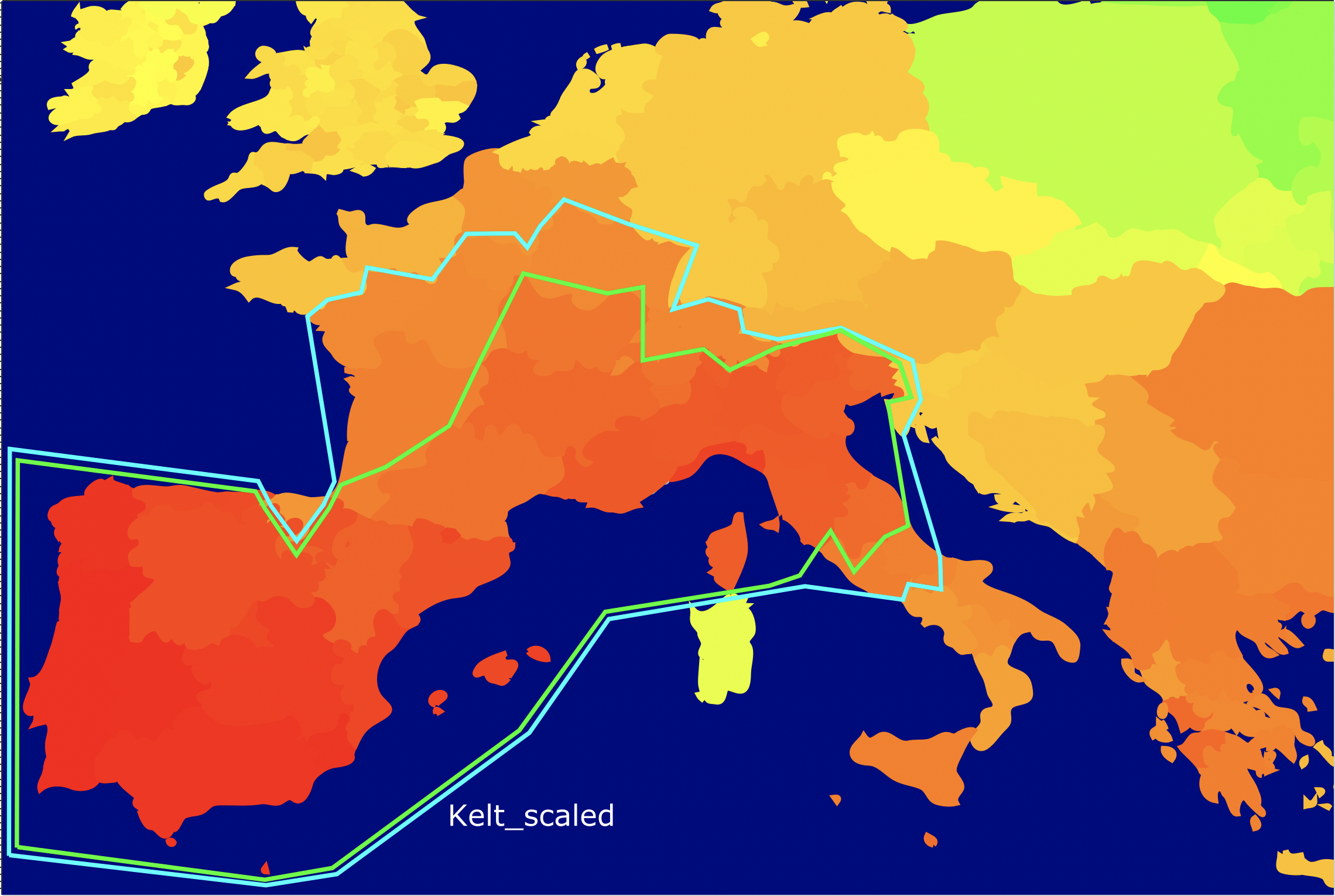
For Portuguese, Spanish_Galicia:HG01704, and Kelt
Portuguese is the average Portuguese
HG01704 is the closest Galician or Portuguese to Kelt
Kelt is the website author
The Galician map (not shown) was identical to the Portuguese
Made with G25 Europe Heatmap PLUS by Girko Varpa
Displayed both as carousel and separate maps
The cyan blue contour groups all regions as close to or closer than Swiss_German
The lime green contour groups all regions as close to or closer than Swiss_French
Note how Basques are just outside cyan for Kelt and HG01704, and outside lime for Portuguese
This means from North to South, Galicians and Portuguese range from Alpine to Atlantic
Since Swiss_French is Alpine but Swiss_German is lowland, the whole range is still Alpine
The Basques are genetically the most Western or Atlantic people in Europe
The Galicians are genetically the most Central-European or Alpine people in Iberia
According to several independent measurements, both Galician-Portuguese and all Swiss are tied for the most Western people in Europe after the Basques and non-Galician Spaniards
Carousel:
Separate maps:
Portuguese:
Spanish_Galicia:HG01704:
Kelt:
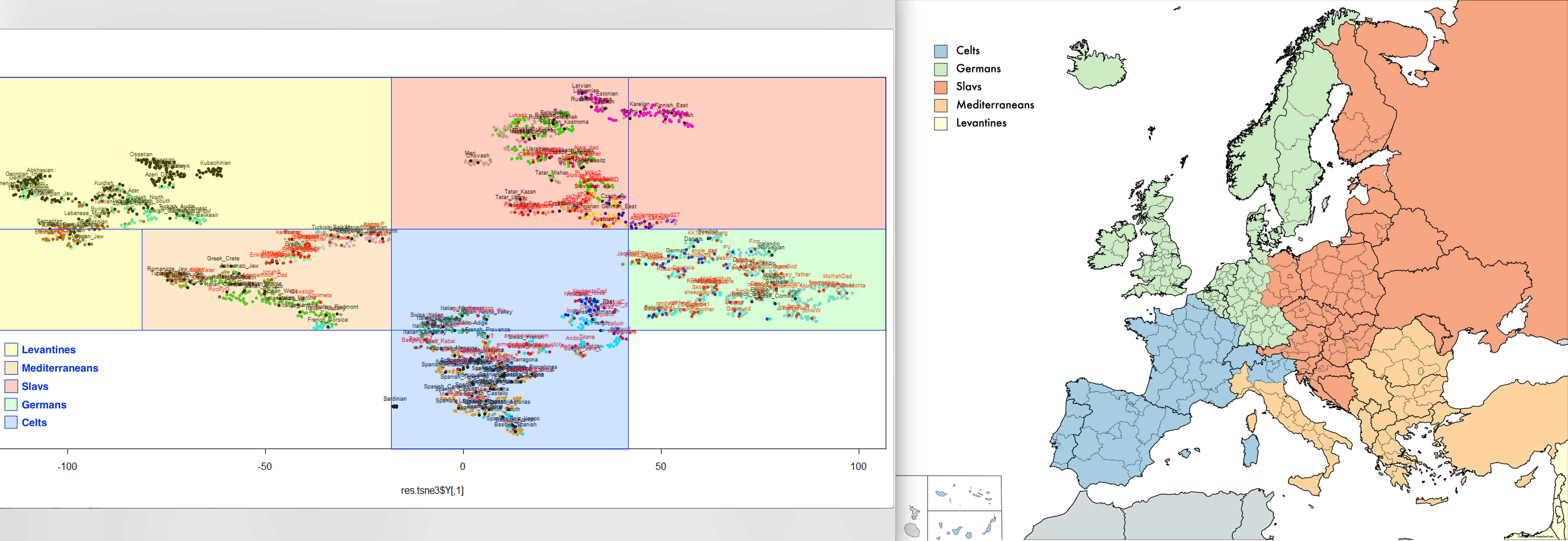
Portuguese and Galicians range from Atlantic to Alpine respectively, not Mediterranean:
Autosomal t-SNE (perplexity: 20; dimensions: 2) of European and Levantine populations:
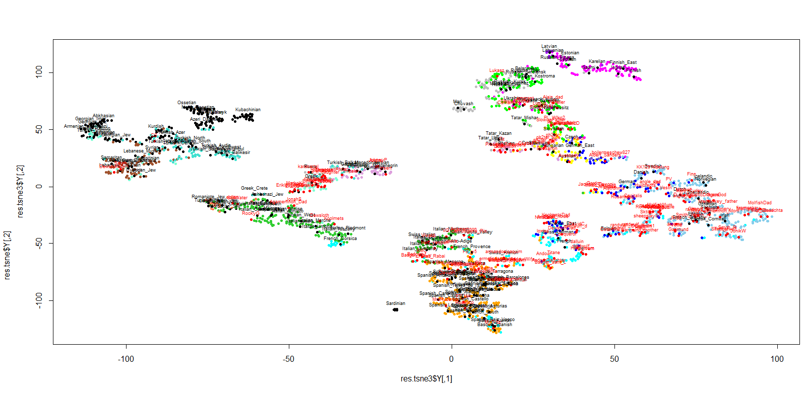
Kelt location:
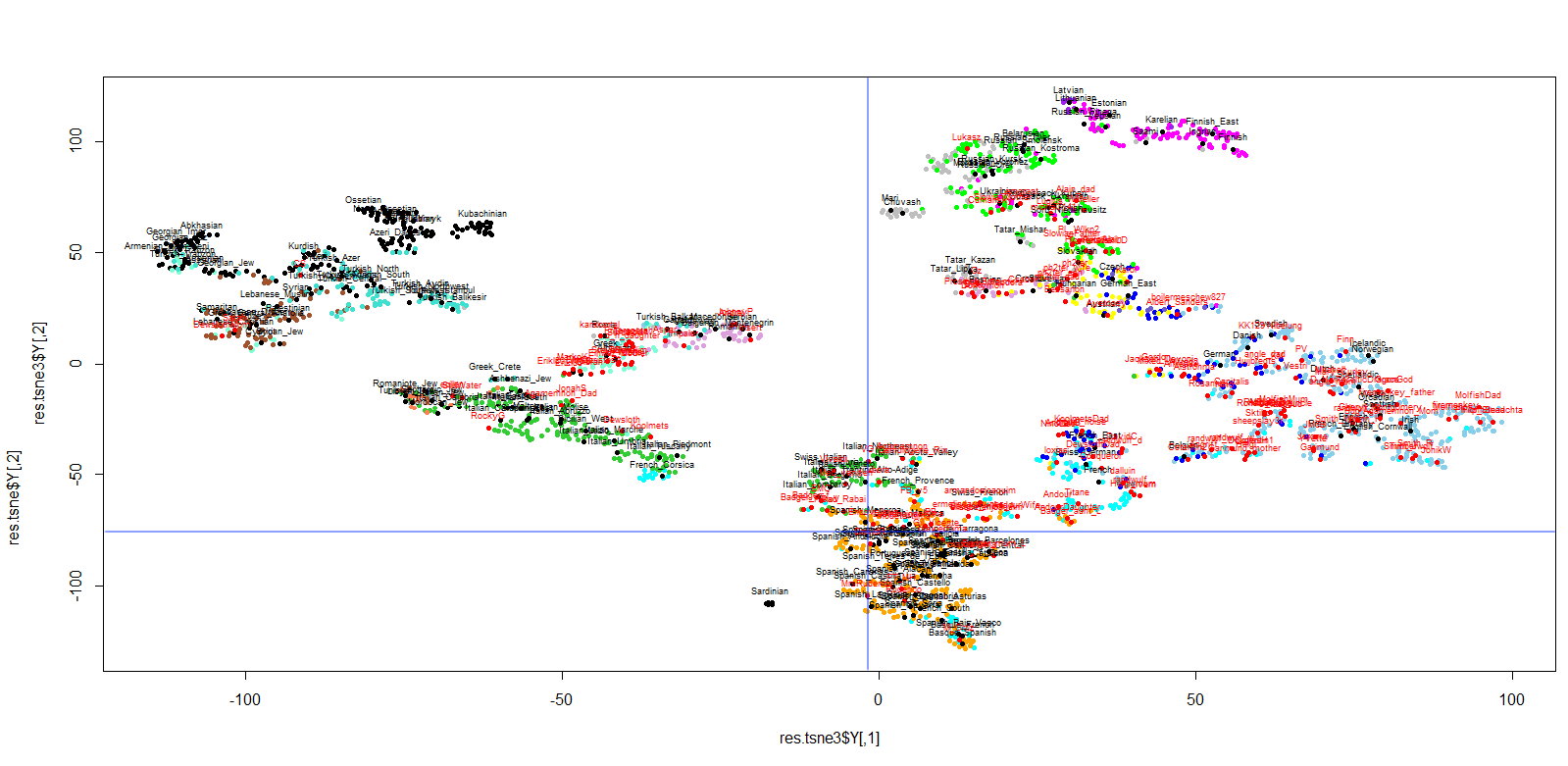
Geographical correspondence to t-SNE:
Kelt is an individual of exclusively Northern Portuguese ancestry from Porto and nearby towns.
Using the Vahaduo G25 Genetic Distance Calculator, Kelt_scaled is closest to Portuguese, followed by Spanish_Galicia, whereas Kelt_unscaled is closest to Spanish_Galicia, followed by Portuguese.
This is Google's AI Overview for the question "how do scaled and unscaled G25 coordinates distance differ in meaning?":
Scaled Coordinate Distance
Meaning: Weighted by eigenvalues to reflect how much total genetic variance each principal component (PC) holds.
Impact on Distance: Early dimensions (broad continental splits) matter a lot, while higher dimensions (after PC10) are heavily penalized and contribute very little to the final number.
Use Case: Best for general, stable distance rankings and modeling that closely align with formal FST and global PCA stats without over-relying on noise.
Unscaled Coordinate Distance
Meaning: Raw output from the principal component analysis where every dimension has an equal voice regardless of how much total variance it represents.
Impact on Distance: Higher dimensions carry equal weight in the math, meaning unique local drift or minor population-specific markers dominate the distance value.
Use Case: Useful for specialized research into deep regional isolation or micro-structure, but risks distorting general closeness via overfitting